Introducing MapKit JS
Introducing MapKit JS
WWDC 2018
Get a MapKit JS Key
https://developer.apple.com/account
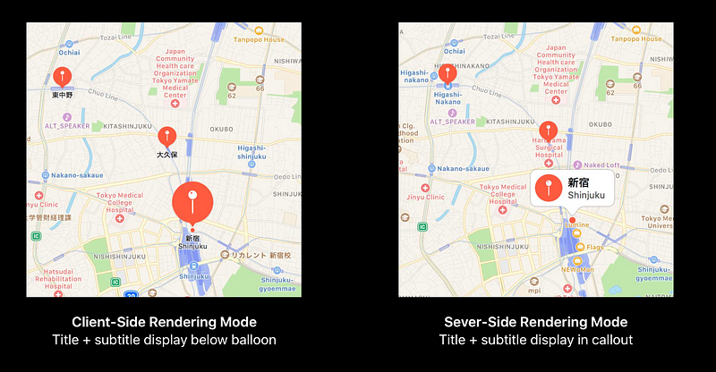
Client-Side Rendering (CSR)

Labels-Only Client-Side Rendering (LO-CSR)
Optimized for low-performance configurations
Server-Side Rendering (SSR)
No WebGL? No Problem
Adaptive Rendering Modes
- An ideal mode for every client configuration
- The best mode is automatically chosen
- Most users will get either CSR or LO-CSR
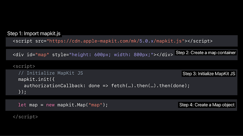
Using MapKit JS on Your Website
Configurable Controls for Every Scenario

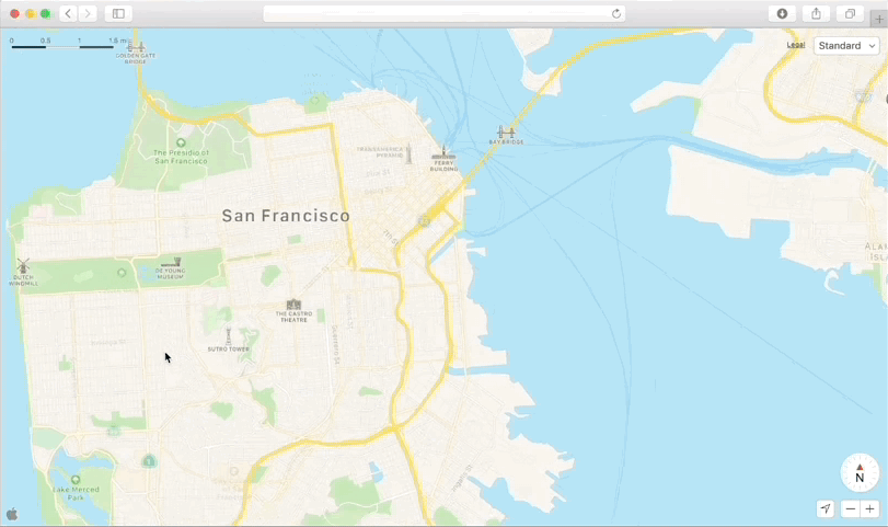
Moving Around the Map
- Geocoding retuns a coordinate and a region
- Search returns a boundingRegion that encloses its results
- User map.showItems(Items) to set a region which encloses items
Responding to User Interactions
- Following the model of DOM events

Annotations
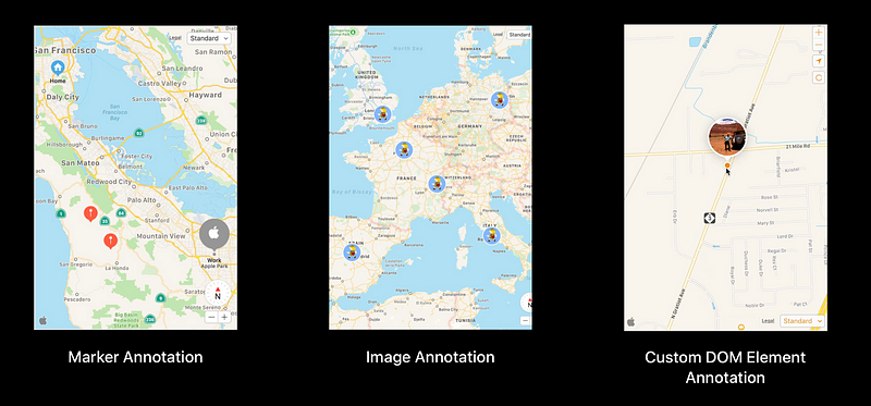
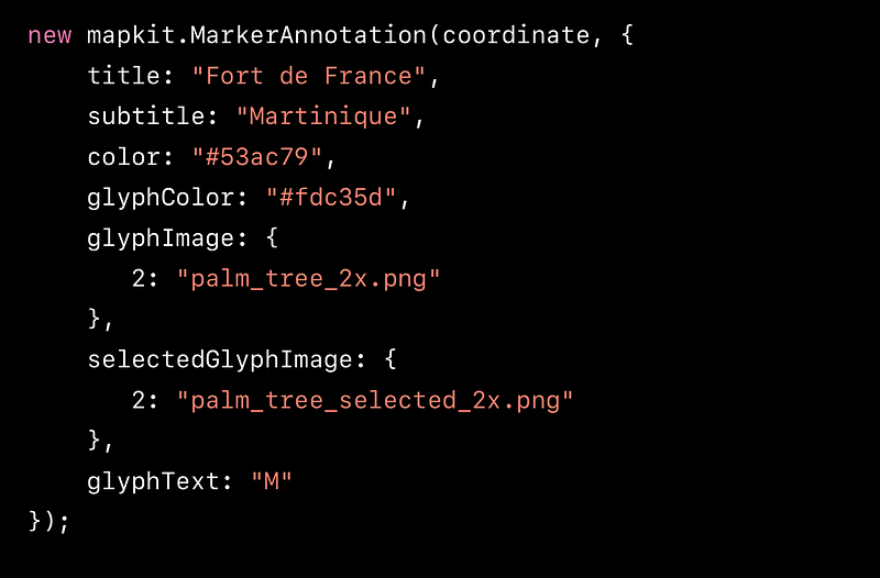
Marker Annotations
Managing Clustter
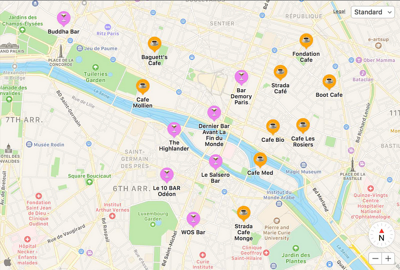
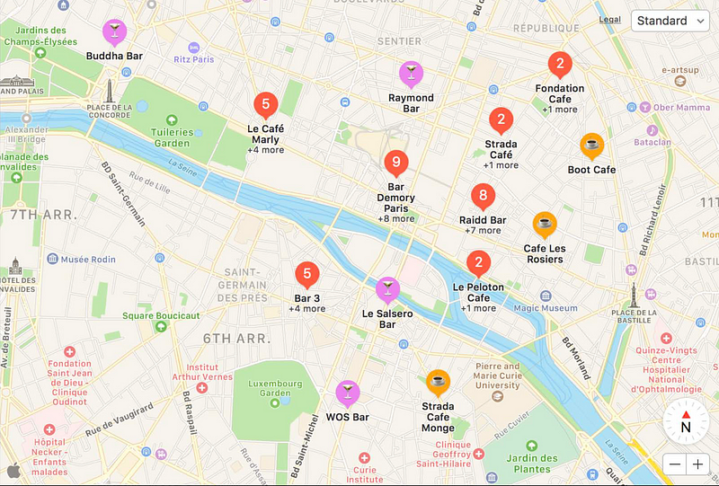
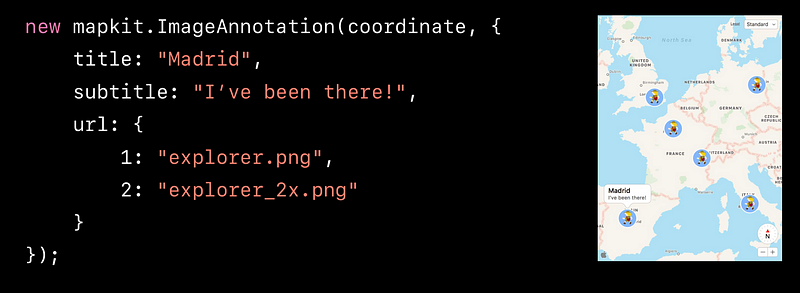
Image Annotation
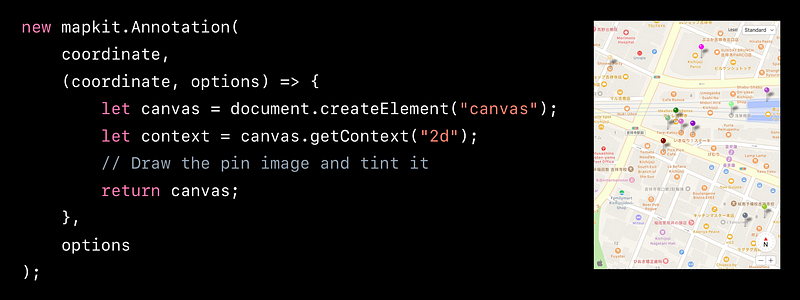
Custom Annotation
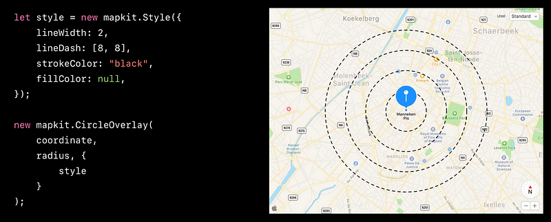
Circle Overlay
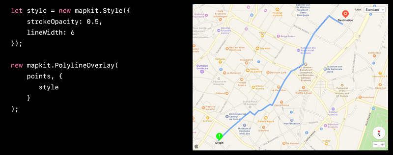
Polyline Overlay
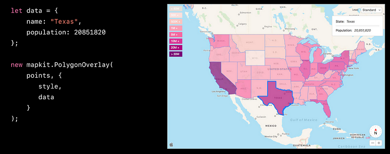
Polygon Overlay
GeoJSON Import
- Create annotations and overlays from GeoJSON geometry
- Customize annotations and overlays through delegate methods
Using Apple Maps Services in MapKit JS
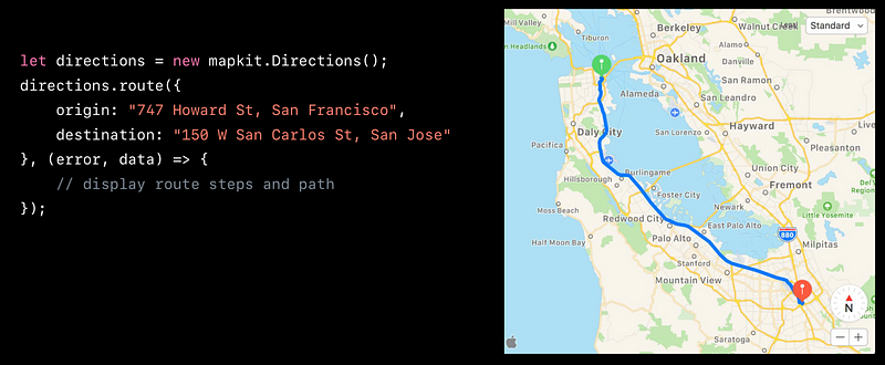
Using any service requires the same 4 steps
1. Create an instance of service object
2. Specify request parameters and options
3. Make a request
4. Handle the response
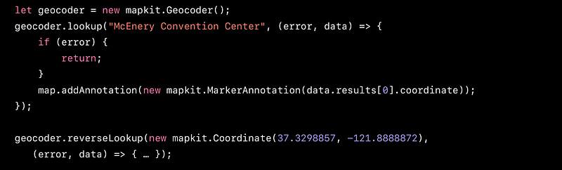
Geo Coding
Search

Search AutoComplete

Directions